Harvesting the bounty of the Central Sands is already underway –peas and snap beans are on the way to consumer’s plates and sweet corn, potatoes and carrots are just around the corner. As we watch and enjoy this remarkable productivity unfold, it is a good time to reflect on what makes it all possible. The Central Sands themselves and the underlying aquifer of groundwater laid down by glaciers 25,000 years ago and constantly recharged by rainfall, snowmelt / runoff are the corner stones in the foundation. Maintaining the delicate balance between the water resource and the needs of everyone who uses and depends on it is an ongoing challenge that we all must be a part of so future generations will enjoy the benefits of this unique area.
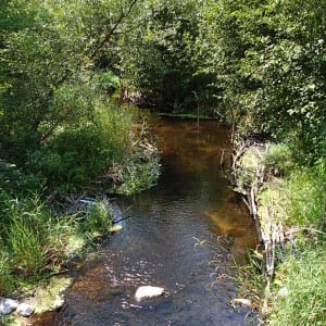
One particular area of focus is the Little Plover River watershed in northern Portage County. The Little Plover is a trout stream and an important drainage outlet that meanders its way westward from its headwaters east of the ancient Johnstown glacial moraine through wetlands, woods, farmland, and the homes, parks, businesses, and industries of the bustling village of Plover to its confluence at the Wisconsin River south of Stevens Point. In recent years, the Little Plover has experienced highs and lows, which have ranged from flooding and ruined basements in some years to reduced flows in others. Although the little stream has persevered through it all and remains a great place to fish and enjoy the outdoors, everyone who lives in the watershed is concerned about its future and is working to secure it.
Many people rely on the groundwater underlying the Central Sands. The village of Plover population is rapidly expanding with its 12,000 citizens, all its homes, businesses and parks, the long established food processing and paper industries, the potato and vegetable farmers who settled here generations ago, and those who like to fish and enjoy the countryside. Everyone uses the groundwater, and everyone must work together to protect it.
The Village of Plover, the farmers and food processors in the watershed are meeting the challenge head on with an ambitious and multi-faceted approach which involves:
- Moving the source of groundwater pumping for municipal use from a half mile from the river to two miles; this involves great expense to its taxpayers but will reduce demand on the aquifer.
- Working with vegetable growers and food processors to lessen the impacts of agriculture by diverting 1000 acres to conservancy areas and wetlands to promote groundwater recharge. In this program, Del Monte has placed 300 acres into grassland to cool the water used in their snap bean processing plant and return it to the groundwater.
- Working with the Department of Natural Resources and the Portage County Land Preservation Committee to acquire an initial 100 acres of farmland that will be used to recreate a woodland, prairie, and wetland Conservancy. This is the first step in a broader master plan, which will create hunting, fishing, trapping, hiking and cross country skiing in concert with an educational mission. This is in addition to the 19 parks already established in the village!
- Voluntarily redesigning crop landscapes to switch from long season baking potatoes and forage crops needing 120 to 130 days of irrigation to short season red potatoes, snap beans and sweet corn that need only 50-80 days of irrigation, the potato and vegetable growers in the watershed are cutting the water use by close to 50%.
- Collaborating with Portage County to redirect storm water to the Little Plover headwaters to increase recharge.
- Actively working together with State and Federal Agencies and the University of Wisconsin to monitor progress with flow monitors in the river and a network of monitoring wells continuously measuring groundwater depths throughout the watershed.
- Seeking long-term solutions through research being conducted by the UW, the Wisconsin Potato and Vegetable Growers Association, the Department of Natural Resources, the Natural Resources Conservation Service and the Wisconsin Geological and Natural History survey.
The resources and energy being invested in this relatively small watershed are indeed impressive, and they reflect the commitment of everyone in the area to work together to protect these assets that we all depend on. As Dan Mahoney, Village Administrator for Plover says “It will take the combined efforts of all well users adjacent to the Little Plover River to restore healthy flows to the river. The village of Plover has taken and will continue to take an active role in promoting voluntary solutions.”
Along with the Village of Plover, the WPVGA has partnered with researchers from the United States Geological Survey, UW – Madison and the WI Department of Natural Resources in a Little Plover River Modeling project. Along with providing funding for the project, the partners are also providing cropping and water use data to create a more accurate model using actual data related to surface water use. New areas of consideration are all and actual surface uses to include native species grasslands and woodlands and actual evapotranspiration of all land uses. Aquifer recharge and timing of water use are areas of expanded study and important pieces of information to better understand each watershed.


